
The
Greenwich Bay Watershed Group
Our habitat is the entire Greenwich Bay watershed. There is the bay itself, estuaries and creeks, fresh water brooks, ponds, swamps and terminal bogs, coastal and inland plains, and uplands. On top of all of this ecological infrastructure, thousands of people live, work, and play. They have created their own ecology, that of marinas, superhighways, railroads, airports, farms, parks, industrial areas, and a main street complete with performing arts and a historic old state house.
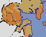
Look at it this way: 26 square miles of surrounding watershed feed the five square mile shallow bay. When you peer under the surface, you see underground water moving at a snail's pace through the uplands and plains to the bay. Unless a natural process intervenes, all that is bad in that underground water can seep into the bay,
The five square miles of water surface and coastal plainswe are concentrating our efforts on the area where we live and the habitat that it provides for creatures of the sea, the land, and the air.
- The Bay Greenwich Bay is the focal point of our habitat. It is the weather generator that sustains the Tamarack Wetlands and its stands of Spruce and Larch. Greenwich Bay attracts the birds that seeds our wetlands and uplands with both special and noxious plants. The bay provides the habitat for the fishes and algae that have brought all of us together to support the Special Area Management Plan.
- Greenwich Bay Watershed The truth is that Greenwich Bay is endangered by what flows through its fresh water watershed. Chemicals from the watershed kill plants and animals in the bay, Bacteria from the watershed make shellfishing an unpredicable occupation. It is to the watershed that we turn for most of the bay's ecological problems.
- Baker's Creek, Buttonwoods Cove and small creeks
- Baker's Creek Barrier and the long beach fronting Budlong Farm
- Buttonwoods Cove Barrier
- Tamarack Wetlands
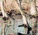
- Loon Swamp
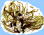
- White and Red Cedar Uplands The flora and fauna of our uplands is the most obvious connection to the specialness of
- Oak Forests
Click
here to flip through GreenShed detail sheets
Home (Top)